Around the Eamont

The pretty River Eamont flows out of Ullswater and amongst the meadows of Edendale until it reaches the River Eden itself. It took a walk around Eamont Bridge village and Brougham: a walk to which I gave a page earlier: the Eamont Bridge and Brougham Walk. Then I added on a loop to Yanwath.

It is a pleasant walk, on a level, around thousands of years of history: the Stone Age at one end, Roman and mediaeval at the other, and Brougham Hall, of many ages, in the middle. Mainly though, it is the fields and the playful river.

The route: map

Maps

Books

See also:

Grey Mare’s Tail and Loch Skeen

At the top of Moffatdale, a beautiful cataract cascades down a fearsome gorge. An isolated spot, at the end of many miles of narrow road, with a National Trust car park beneath a precipitous hill, and a bridge across the burn. The recent rain had swollen the waters and the waterfall – the Grey Mare’s Tail.

I came to explore and admire. Looking up, on the left is a slope which rises to White Combe (Dumfriesshire’s highest point)l on the right its twin; and between them. a plunging gorge. I first followed a path up the White Combe side, to a vantage point for the Grey Mare’s Tail. It is magnificent, and no photograph does it justice. From that point there is a barrier – the path beyond has collapsed and access is barred. So I returned and climbed the other side, wondering is there is a way across above the fall.

It is a steep path, clinging to the side of the hill – barely less than a cliff. It is a well-made path, and ful kudos to the National Trust for Scotland for creating and maintaining it in a challenging landscape – spanning many cuts in the slope where lesser burns course down the gorge. A steep climb higher to the level of the waterfall, and then it becomes easier, almost level, and leads on.

The moorland here is bleak and soaked. The rain began. Very soon I was bleak and soaked. Two walkers were on the other side of the river – I called over and they said that they had crossed at the loch – my destination – and they were unable to find a way back.

Suddenly the loch appeared: Loch Skeen. It is the largest loch in the Moffat Hills – possibly in the county, and here, isolated away from the sight of any other than those who have made the effort of the climb to admire it.

It might at a stretch have been possible to cross here the river that spilled out of the loch, which went on to thunder over the Grey Mare’s Tail. (Had I done so, I could hardly have got wetter than I was.) There ahead, over the stream and far over the moor, rose a great, forbidding white dome: White Combe. It was entirely covered in snow; trackless, sleep, icy and with the top hidden in cloud. If I had arrived earlier in the day when it was dry and there were more hours of daylight left, it could have been worth a try. There in the cloud and snow it looked defiant. (Aye; but I know where you are now, and how to reach you when the snow has gone.)

Beyond were other hills clad in snow. The Southern Uplands are not mild country-cousins of the Highlands: these can be serious mountains and, unlike the Lake District, are isolated and empty. One summer, I will see what the tops offer when the snow has gone and the heather is in bloom.

Down I came on the stone path, with a respect for these hills.

I followed the climb with a drive, up the dale and to St Mary’s Loch – a sheet of water equal to any but unfrequented. I followed up round to the Megget Reservoir, a huge loch in itself, if dammed by man, and past Broad Law (Peeblesshire’s highest point). Apart from there being nowhere to park, the ground up to it looks ankle-turning. That would need more research. I know one person who has climbed it. I was just passing by though, as the sun began to sink.

The landscape here is breathtaking. The hills are bun-shaped: rounded and steep-sided. Local people must understand them – except that there are no local people in these deserted hills – another contrast to the Lake District, to which I then returned, after a fascinating, soaking day.

See also

Real Lancashire Boundary Walk completed after 432 miles!

Hat off to Philip Walsh:  he has completed the first walk of the Real Lancashire Boundary Walk.  The path is 432 miles long, circling the whole border of Lancashire, from Blackpool to Blackpool, taking in the coastline, the Mersey, the Pennines, and the Furness Fells.  It is a mighty achievement, taking 30 days.  He finished in Blackpool on Sunday, 29 July 2018.

I will finish the mapping of this ‘Reet Gradely Red Rose Ring’ when Philip has recovered enough to fill in the gaps!

Real Lancashire Boundary Walk: lengthing the Mersey

Philip Walsh’s Real Lancashire Boundary Walk continues apace.  On 30 May , Philip set off from Blackpool and was in Liverpool, Lancashire’s Queen of the Seas, on 2 June.  Since then it has been the long haul up the River Mersey.

On 3 June, Philip reached the southernmost village in Lancashire; Hale.  Tonight he was able to sit in a pub in Shaw.  One week and the Mersey conquered.

Soon comes the heavy yomping as the county border runs through the Pennines.  We’re with you all the way, Philip.

Lancashire Border Walk: it’s on!

On Wednesday, Philip Walsh, the Chairman of the Friends of Real Lancashire, will set off on an epic Lancashire Boundary Walk; a month-long walk along the whole border of Lancashire looking to raise money for the North West Air Ambulance.

Starting under the shadow of Blackpool Tower at dawn on Wednesday 30 May 2018, Philip will begin by heading south along the coast towards Liverpool.  From Liverpool, the route follows up the Mersey, and as it climbs into the Pennines the tough part begins.  A trail through the ridge of the Pennines is no mean fear on its own, but after a week or so of long, wearing days it would take, well, a large, retired policeman like Philip to do it.   The Pennines are not the end:  there are still the Furness Fells, up to the Hardknott Pass, Dunnerdale and the long coast back to Blackpool.

The idea of a Lancashire Boundary Walk was proposed by the Friends of Real Lancashire and this site was largely created to help develop this and similar projects, so we are delighted to have played some part in this adventure. We wrote previously about a “Reet Gradely Red Rose Ring“, and will try to keep a feed from Philip’s blog as he goes.

We will also be mapping the route.

In the meantime, please give generously to the charity Philip is supporting.

Links

Keeping fit the democratic way

It’s that time again, and we have been getting fit the democratic way – walking, bending stretching and lifting weights, all for election day tomorrow; Thursday 3 May 2018.

We have the local elections in much of the land tomorrow, and the teams have been out with rosettes of all colours, all driven down to that one date, to try to persuade you that our candidates are the most fit for office.  It is though an exercise in fitness training:  I have walked several miles with leaflets and questionnaires: speed without compromising politeness and looking presentable, at all hours and in all weathers, and much more.

I recently visited Devon.  Even in the towns the street climb steep moorland hills, and I had to admire the dedication of the canvassing and delivery teams scaling the heights, and then scooting round distant villages so no one is left out – leaving nowhere out is an essence of democracy.

I will have to revisit this another time, but in the meantime, please do not forget to get out there and vote.

Walks around Leaveland

A quiet Kentish Lane, turning past the hedgerow to a country pub with a fire burning in the grate – this is Leaveland, a hamlet at the fringe of the North Downs in the north of Kent, simultaneously in the middle of everything and in the middle of nowhere.

The village is not on the North Downs Way – that loops away from here to the south, but has its own network of lanes.  It has not great sights, though it is not farm from the manicured estate at Belmont, and wilder woods.  Having enjoyed the company of the Red Lion, you may take any direction of the compass and more to continue your journey on footpaths.  It even takes a footpath to reach the village’s own church, separated in ‘Leaveland Court’.  There is no obvious long-distance route, which just means that your journey is not prescribed by regulations and directives.

The path from Leaveland to Bethel Row

I love the places hereabouts, with names like Throwley Forstal, Tong Green, Molash and Snoadstreet.  These too must just get on with life as they will, unbothered by the things that seem to get urban types wound up in knots.

Where better on a spring afternoon (yes, its still a chilly spring, but what does it matter with the wonder of creation laid out before you?)

I think west over the common from the pub, then south down the bridleway to Molash and then up the hill into the King’s Wood – a place to be lost in.  Or anywhere really.  That is a thing about Leaveland – it is a village to enjoy within, but eventually there is more to be seen by opening your horizons – I will lift up mine eyes unto the hills – and, well, leaving.


Parkrun

So that is what parkrun is, as I was propelled to join up and take part in a run – perhaps as some payback for my being rude about it at the New Year.

Three miles (sorry, ‘5 k’) around and around the park, each runner timed to the second.   And in the winter trees we were saluted by magpies and parakeets.

Yes, I have been dismissive of doing just thirty minutes of exercise and then going home rather than taking all day walking across country, and yes I was a bit peeved when runners filled to bursting the place we where had planned a peaceful New Year’s walk.  Actually though, honestly, I do not have the time to go for all-day walks very frequently especially in the winter time and nor do most people, so this telescoped exercise is ideal.

I have not been running for many years, and when I dug my old trainers out they disintegrated in my hand (which meant a quick dash out for supplies).  Still, I keep my legs fit, so how hard can it be?

I found it very well organised, by keen volunteers (and volunteers with smiles on their faces, which you do not always find with events).

We came to the park, and it was filling up quickly. Parkrun – oh the people; so many people.  If ever tempted to bewail the nation sinking into urbanised slobbery, come and have a look at this gathering and it will dispel the idea that we are lost.   The spirit of Thomas Arnold is alive and well – a healthy mind in a healthy body.  (And while it is not a specifically Christian event, I could not help noticing the number of people from local churches and a scattering of evangelical T-shirts – muscular Christianity built the Empire and still sustains the nation.)

And so off we went, and after just under 30 minutes I was jogging through the “funnel” for my time to be recorded.  Then off home, and the rest of the morning to fill.  (It was tempting to pull some boots on and head off across the common, but things had to be done….)  Telescoped exercise though it is, it is good exercise and leaves the day to achieve more things.

Whatever I have said before, it’s not bad, actually.  I will promise not to be rude about parkrun again.

Ulva – eilean na mo chridhe

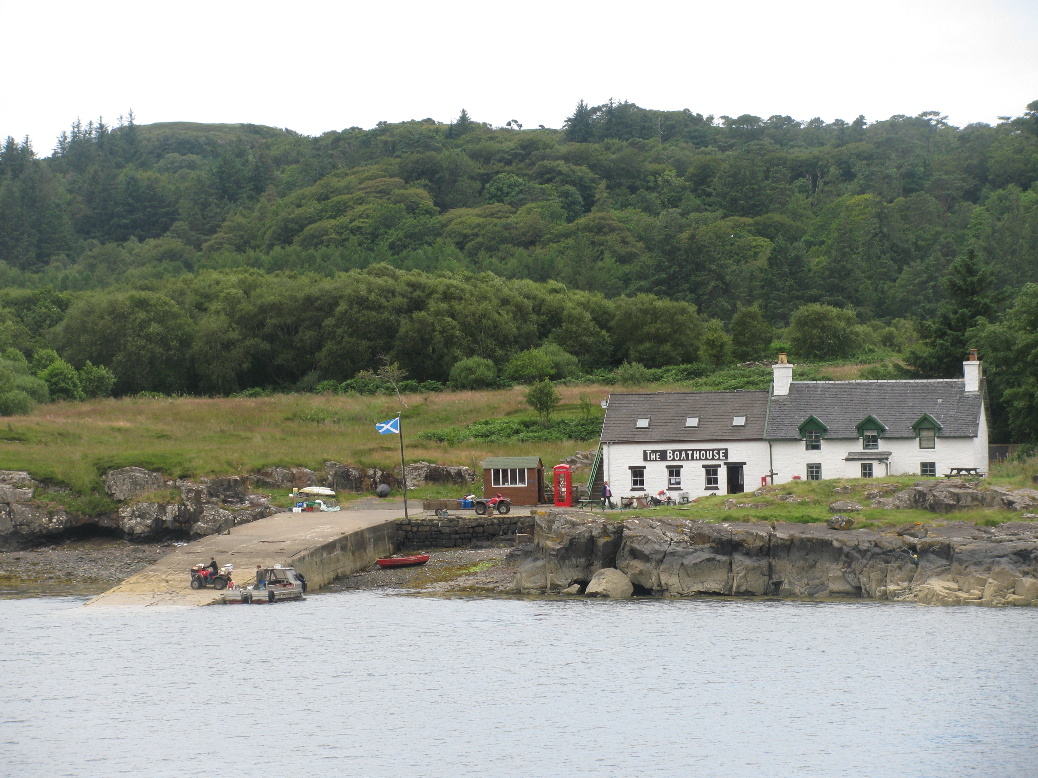
It wasn’t the eccentricity of the place, or the light uncertainly playing on the water, the soft, jagged shorelines hiding distance and size, and the promise of wider lands beyond, but the emptiness so close but far away, and the eccentricity. Ulva. An island clasped close to the shore of Mull.

Mull is a huge island beside other in the Hebrides, its mountainous fingers reaching westwards into the sea, and Ulva, like a finger of Mull broken off, sheltered by the larger island and so close that I had to keep reminding myself that the ferry not just over a river but across the sea to a new island.

Ferry stage on Ulva

The ferry, between Mull and Ulva, is a wee boat with room just for a few travellers and the boatman’s dog.  It is summoned by efficient technology:  a wooden board at either staithe where you slide a panel to reveal a red rectangle, which is the sign for the ferryman to come over to you.  It works, and it is sustainable tech.

We stepped ashore on the island and at once were lost in the emptiness of it.  The undramatic crossing suggests a little place of little consequence, but Ulva is nearly 5,000 acres: land hidden behind the rise from the shore, and plenty of island to get lost in.  It reaches out into the Atlantic Ocean, and beyond it appear many more islands begging to be explored.

Once the island was the home of the MacQuarrie clan, all not gone from their home, which explains why the name is found more in the colonies than in Britain – it I a famous name in Australia.

Last week all this was called to mind when I read that the island is for sale.  I read that the inhabitants of this great island are hoping to buy it – all six of them. I hope they have deep pockets, from farming the gorse and the scrub. It’s beyond my touch by a few million pounds, but I still have memories.


What country, friend, is this?

Twelfth Night – the last of Christmas.

Now, if like Viola and Sebastian you happen to find yourself shipwrecked and cast onto the shore of Illyria, you might find that you are without you necessary walking kit.

And what should I do in Illyria?

In these circumstances, the first task is to find shelter, then sustenance.  Food can wait, but Not to be abed after midnight is to be up betimes.  Illyria is well provided with forests, but keep far enough up that Still you keep o’ the windy side o’ the law.

As to food, If music be the food of love, play on; but that will not fill a stomach.  You might find a tavern but That quaffing and drinking will undo you: I heard my lady talk of it yesterday.  Short of finding a lovelorn duke to employ you, your survival skills are needed from the moment you have crawled onto the shore But jealousy what might befall your travel, Being skilless in these parts; which to a stranger, Unguided and unfriended, often prove Rough and unhospitable.

Have a fine and exciting 2018.