On Wednesday, Philip Walsh, the Chairman of the Friends of Real Lancashire, will set off on an epic Lancashire Boundary Walk; a month-long walk along the whole border of Lancashire looking to raise money for the North West Air Ambulance.
Starting under the shadow of Blackpool Tower at dawn on Wednesday 30 May 2018, Philip will begin by heading south along the coast towards Liverpool. From Liverpool, the route follows up the Mersey, and as it climbs into the Pennines the tough part begins. A trail through the ridge of the Pennines is no mean fear on its own, but after a week or so of long, wearing days it would take, well, a large, retired policeman like Philip to do it. The Pennines are not the end: there are still the Furness Fells, up to the Hardknott Pass, Dunnerdale and the long coast back to Blackpool.
The idea of a Lancashire Boundary Walk was proposed by the Friends of Real Lancashire and this site was largely created to help develop this and similar projects, so we are delighted to have played some part in this adventure. We wrote previously about a “Reet Gradely Red Rose Ring“, and will try to keep a feed from Philip’s blog as he goes.
We will also be mapping the route.
In the meantime, please give generously to the charity Philip is supporting.
The short walks available on Dartmoor are innumerable, but some are out of the ordinary, and one such was a walk to unexpected industry on the high moor.
Setting off from a car park by the Pump House, east of Merryvale, we walked south over the moor to the isolated Yellowmeade Farm. To the east rises North Hessary Tor, with its tall television mast – beyond the hill is the dark grey, elegantly ugly prison, and the village that has grown around it, Princetown, and this unseen place shaped what we were about to come across.
Ahead, beyond the farm, was a sudden spur jutting over the valley, flat-topped and man-made, and around it a complex of shattered granite-built buildings. This was a lost quarry village, from when the hillsides were blasted out for stone to build the Dartmoor Prison, and Princetown.
The lake in the quarry
Turning aside from the path, we passed through a gap in cliffs and suddenly an unexpected site – a tranquil lake, lying where there had been a quarry, hemmed in all about by sheer cliffs, but cliffs made by dynamite and pick-axe. It is always a wonder to think how huge blocks of the unyielding stone of the moor could be hauled away, but over such broken and precipitous ground it is all the more so. We had walked, we realised, much of the way on an old tramway, the sleepers still forming the path, but the tramway is to one side and somehow the quarried boulders (go and have a look at Merryvale Quarry by the road to see how big they are) were hauled out time after time to create this new valley.
Passing round and out of the lost village, the track reaches a cross-track to King’s Tor, and this we took, crossing as we did so the embankment of the old Dartmoor Railway – an industrial railway which once crossed the moor to Princetown.
We then compassed round the side of the hill, coming to a stop at another powder-blasted cliff face and a sheer drop too far to contemplate – and yes I was about to creep around, but I did not want the children to risk it, so we went up and round (and of course darted to the closest summit on the way and down again).
Lower down, the best path is that of the railway, which curves around King’s Tor. The views here are to the west, to Vixen Tor nearby, the green valley of the River Walkham and Sampford Spiney beyond. Here too are tumbled ruins of quarry buildings, and strangest of all a stack of huge granite pieces, all dressed and carved and abandoned by the track. They are supporting quoins carved for the Victorian London Bridge, but rejected as they were just too small.
Quoins for London Bridge
The railway leads north and all round the hill: the main summit known as ‘King’s Tor’ is in this part (not as high as the southern top of the hill as it happens) and can be climbed on the way back. Then path leads back to the first quarry and its shattered village.
The back the way we came to the farm and the car park.
It is a modest walk of a few miles. The moor seems bleak and empty, but then to come across this unexpected industry, though I cannot call it beautiful, is as if to find a whole new moor and a glance back in time to when this part of Dartmoor was abuzz with work. Here they won the stone to built HMP Dartmoor, and Princetown, and London Bridge, and Nelson’s Column. Yes – the noble captain stands atop a stack of King’s Tor Granite.
There is a visitor’s centre over the hill in Princetown which tells of the nature and mysterious prehistoric remains of the moor. Industry though is all part of the story.
Devon is a place I could wander forever. The vast extent of the high moorland of Dartmoor is both beautiful and fearsome, inviting and forbidding: when the sun is out, there is little better than the freedom to wander at will on what looks like an unbounded landscape; but when the icy wind cuts to the bone or the cloud descends on the hill, there is no shelter.
It was a few years ago that I climbed the highest hills on the moor, Yes Tor and High Willhays, two neighbouring peaks, the latter being also Devon’s county top.
It is a modest walk – just 7 miles – mainly involving climbing (even the precipitous descent seemed to be climbing) but well worth it for the views, the location, and for bagging another county top. It did not finish where I started, and would not change the distance much to do so.
The walk is within the army’s Dartmoor live firing ranges, so you will need to check the range timetable before setting out: there is a link below.
The Meldon Reservoir
The walk
I started at the Meldon Reservoir – a beautifully calming stretch of water, and while as a reservoir it may be manmade, it lies in a natural valley, and the water falls from the heavens as to any normal lake, so it can count as one, apart from the dam, which is the first and almost last artificial thing to cross.
A path leads up from the dam, winding up the slope of Yes Tor. The hill rising above looks forbidding, but on a sunny day (I was blessed with a sunny day) it is an invitation.
An inhabitant of Dartmoor
In the days before exact, scientific surveys, Yes Tor was believed to be the highest point on the moor, and in the county. It is certainly the more prominent one to the eye from the nearest villages. (There has been this confusion on Dartmoor, perhaps understandably for want of anywhere to stand to measure the hills other than by the impression of the eyes: until the early nineteenth century Cosdon Hill (1,804 feet) was thought to be the highest on Dartmoor, because it looks prominent from a reachable village; then the crown moved to Yes Tor, until someone thought to count the hill hidden behind it; High Willhays.)
It is a straight haul up Yes Tor to its rocky outcrop. The views from here are broad in all directions. It looks to the north beyond the bounds of Dartmoor to the rolling hills in the middle of Devon, and westwards to Cornwall across the Tamar Valley. Closer to, to the north-west, is the reservoir and to the north of it a peculiar viaduct apparently to nowhere. The map shows it to carry the old line of the Dartmoor Railway over the West Okement River but no further. (It now serves a quarry, but apparently the line does not cross the viaduct these days.)
The top of Yes Tor is at 2,029 feet above sea level. From here I turned south, down the little saddle separating Yes Tor from its neighbour, High Willhays, which is just ten feet higher. On the saddle my sense of remoteness was knocked a bit by seeing a track running up to the saddle from the east, and a Land Rover parked a little way down it: this place though is within the army’s firing range and access has been driven to it.
The summit of High Willhays stands at 2,039 feet above sea level. It is marked with several rocky outcrops, and it is hard to see by eye which is the highest, so I clambered up each of the tallest. I was not alone; one chap had hauled not only himself but also a ham radio set and a small dog up to the summit (to make a broadcast, he explained, from the top of each ‘Marilyn’ hill).
From here, the views to the south and east broaden across the sweep of Dartmoor, to Great Kneeset prominent at the centre of the moor, and many more around. Below the hill westwards is the deep valley of the West Okement, into which I had to descend later, with stands of woodland amid the bare moorland. To the south is top after top of the peculiar hills of the moor.
The descent from High Willhays looks simple on an Ordnance Survey map (as below). In practice, the valley of the Brim Brook does its best to imitate the West Okement, and the West Okement itself extends with few distinguishing points and is misleading. It takes careful compass work not to end up walking miles in the wrong direction (which did happen to a friend of mine who did the same walk a few months after me but without the aid of a compass).
It is steep and trackless off the tor, plunging down over broken ground into the valley. Sturdy boots are needed or a twisted ankle is promised. Eventually in the bottom of the valley I could track northwards to a little below the head of the reservoir, where there is a ford and a track to the west up and over the shoulder of the Sourton Tors (though I took a lower path, a little less direct).
The Two Castles Trail and the West Devon Way share a route along the lower hills here, though I went to the track of the old Dartmoor railway, which has been converted into a footpath and a trail known as the Granite Way. A little way down here, and I came to my finishing point at Sourton (home to Devon’s weirdest pub, incidentally).
One more county top done, and it was all good warming up for the next challenge….
It’s that time again, and we have been getting fit the democratic way – walking, bending stretching and lifting weights, all for election day tomorrow; Thursday 3 May 2018.
We have the local elections in much of the land tomorrow, and the teams have been out with rosettes of all colours, all driven down to that one date, to try to persuade you that our candidates are the most fit for office. It is though an exercise in fitness training: I have walked several miles with leaflets and questionnaires: speed without compromising politeness and looking presentable, at all hours and in all weathers, and much more.
I recently visited Devon. Even in the towns the street climb steep moorland hills, and I had to admire the dedication of the canvassing and delivery teams scaling the heights, and then scooting round distant villages so no one is left out – leaving nowhere out is an essence of democracy.
I will have to revisit this another time, but in the meantime, please do not forget to get out there and vote.
A quiet Kentish Lane, turning past the hedgerow to a country pub with a fire burning in the grate – this is Leaveland, a hamlet at the fringe of the North Downs in the north of Kent, simultaneously in the middle of everything and in the middle of nowhere.
The village is not on the North Downs Way – that loops away from here to the south, but has its own network of lanes. It has not great sights, though it is not farm from the manicured estate at Belmont, and wilder woods. Having enjoyed the company of the Red Lion, you may take any direction of the compass and more to continue your journey on footpaths. It even takes a footpath to reach the village’s own church, separated in ‘Leaveland Court’. There is no obvious long-distance route, which just means that your journey is not prescribed by regulations and directives.
The path from Leaveland to Bethel Row
I love the places hereabouts, with names like Throwley Forstal, Tong Green, Molash and Snoadstreet. These too must just get on with life as they will, unbothered by the things that seem to get urban types wound up in knots.
Where better on a spring afternoon (yes, its still a chilly spring, but what does it matter with the wonder of creation laid out before you?)
I think west over the common from the pub, then south down the bridleway to Molash and then up the hill into the King’s Wood – a place to be lost in. Or anywhere really. That is a thing about Leaveland – it is a village to enjoy within, but eventually there is more to be seen by opening your horizons – I will lift up mine eyes unto the hills – and, well, leaving.
The yacht slips in across the reef under a light breeze, all hands readied, tense. Silence aboard is not mirrored ashore – over the soft beat of the surf on the white sand is the sound of inhuman screaming.
A turtle swims past with what the imagination might call a knowing look on its age-old face.
A seagrass bed by Danger Island
The sea is alive now, shimmering with fish, and diving to meet them the birds of the isle. A bright, white pair of boobies jostles for a squid. The yacht stands off – the tide is dragging it to the razor-sharp coral.
This is Danger Island, in the British Indian Ocean Territory; a hazard and a beauty. It is a preserve of wildlife which few will ever see, and one of the many wonders those islands afford. There is no walking here, no wind-scoured moorland, no remote vistas over forbidding fell-country – it is in everything the opposite of all the Further Wild should be to a Wildþing, and indeed man may not set foot here by law, but it is a paradise of nature, preserved for all mankind.
So that is what parkrun is, as I was propelled to join up and take part in a run – perhaps as some payback for my being rude about it at the New Year.
Three miles (sorry, ‘5 k’) around and around the park, each runner timed to the second. And in the winter trees we were saluted by magpies and parakeets.
Yes, I have been dismissive of doing just thirty minutes of exercise and then going home rather than taking all day walking across country, and yes I was a bit peeved when runners filled to bursting the place we where had planned a peaceful New Year’s walk. Actually though, honestly, I do not have the time to go for all-day walks very frequently especially in the winter time and nor do most people, so this telescoped exercise is ideal.
I have not been running for many years, and when I dug my old trainers out they disintegrated in my hand (which meant a quick dash out for supplies). Still, I keep my legs fit, so how hard can it be?
I found it very well organised, by keen volunteers (and volunteers with smiles on their faces, which you do not always find with events).
We came to the park, and it was filling up quickly. Parkrun – oh the people; so many people. If ever tempted to bewail the nation sinking into urbanised slobbery, come and have a look at this gathering and it will dispel the idea that we are lost. The spirit of Thomas Arnold is alive and well – a healthy mind in a healthy body. (And while it is not a specifically Christian event, I could not help noticing the number of people from local churches and a scattering of evangelical T-shirts – muscular Christianity built the Empire and still sustains the nation.)
And so off we went, and after just under 30 minutes I was jogging through the “funnel” for my time to be recorded. Then off home, and the rest of the morning to fill. (It was tempting to pull some boots on and head off across the common, but things had to be done….) Telescoped exercise though it is, it is good exercise and leaves the day to achieve more things.
Whatever I have said before, it’s not bad, actually. I will promise not to be rude about parkrun again.
Is there anything more depressing than sitting in a planning meeting, as I am now, thinking about a planned country walk, then seeing the schematics displayed for concreting over it? Well, yes – doing the walk and watching the diggers doing their work. Yet it is coming, inevitably, and here I sit, helpless.
There are wild places aplenty still – go and see them, and quickly.
In Lancashire, one brave and hardy soul is preparing to walk around the whole county, seeing both the heavily industrialised lands, swallowed forever by the works of man, but also the wild fells where a man may stand and look for mile upon mile on anywhen moorland forgetting which century he is in.
Old Shire Lane, south of Chorleywood
I am preparing a new walk, ambitious in its way, to see the edges of Hertfordshire, familiar and unfamiliar. I will get out there to convince myself that this is still a pretty county, with its woods, its meadows and rivers and its broad fields, peeping through in places behind cruel concrete, alas. Still, I have walked the suburban wild before, and there must be more that remains green than the urbanised creep, still?
I have just looked up to see a familiar path on my route dotted along the southern boundary of a development site. I sigh inwardly, powerless.
I must hurry, and see the county, while the county lasts.
It wasn’t the eccentricity of the place, or the light uncertainly playing on the water, the soft, jagged shorelines hiding distance and size, and the promise of wider lands beyond, but the emptiness so close but far away, and the eccentricity. Ulva. An island clasped close to the shore of Mull.
Mull is a huge island beside other in the Hebrides, its mountainous fingers reaching westwards into the sea, and Ulva, like a finger of Mull broken off, sheltered by the larger island and so close that I had to keep reminding myself that the ferry not just over a river but across the sea to a new island.
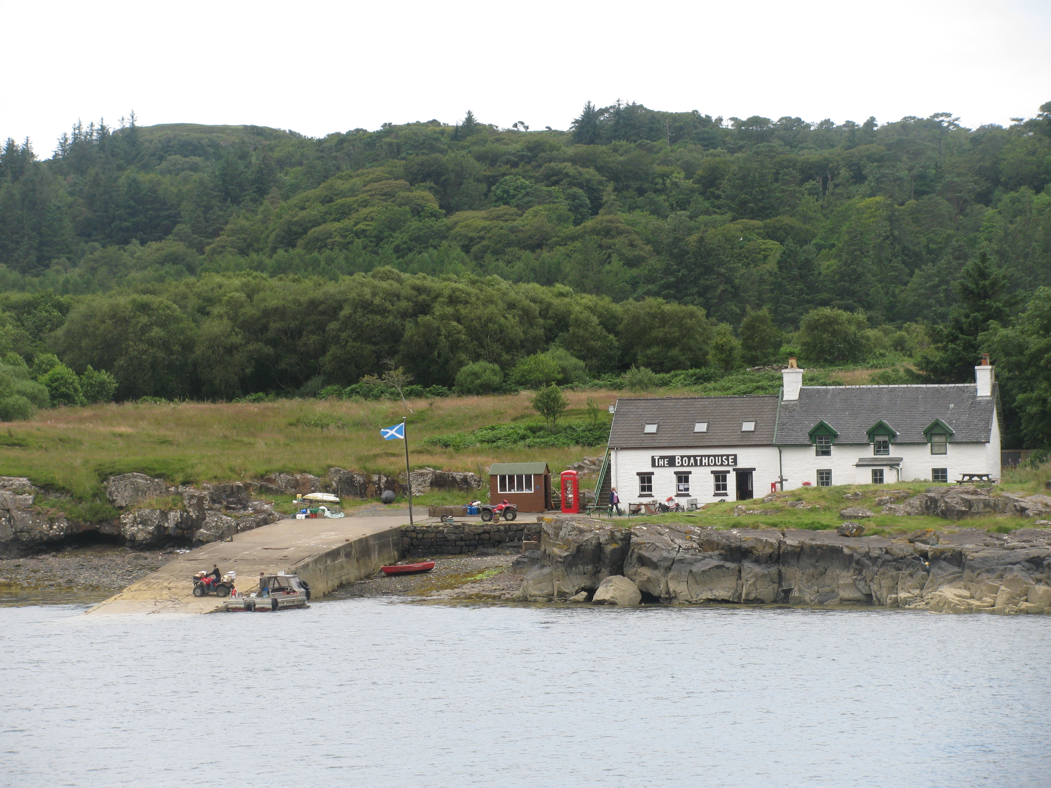
Ferry stage on Ulva
The ferry, between Mull and Ulva, is a wee boat with room just for a few travellers and the boatman’s dog. It is summoned by efficient technology: a wooden board at either staithe where you slide a panel to reveal a red rectangle, which is the sign for the ferryman to come over to you. It works, and it is sustainable tech.
We stepped ashore on the island and at once were lost in the emptiness of it. The undramatic crossing suggests a little place of little consequence, but Ulva is nearly 5,000 acres: land hidden behind the rise from the shore, and plenty of island to get lost in. It reaches out into the Atlantic Ocean, and beyond it appear many more islands begging to be explored.
Once the island was the home of the MacQuarrie clan, all not gone from their home, which explains why the name is found more in the colonies than in Britain – it I a famous name in Australia.
Last week all this was called to mind when I read that the island is for sale. I read that the inhabitants of this great island are hoping to buy it – all six of them. I hope they have deep pockets, from farming the gorse and the scrub. It’s beyond my touch by a few million pounds, but I still have memories.
A long, thin county with wooded hills and broad valleys, Buckinghamshire has variety, which is reflected in the local walks available. The best-known are in the Chilterns, but there is a great deal more to be seen in the county: from the north bank of the Thames to the meadows by the Great Ouse by way of the Chiltern coombes.
It is hard to picture a county boundary walk as such, but please prove me wrong. A ‘Buckinghamshire Way’, perhaps, from the Thames to Olney, or vice versa? That could be a gorgeous trail, and can be featured mapped here.
For a gentle walk, a good option it one of the many village-centred walks , exploring the nooks and crannies of a single village or a group of villages, or going all round the parish boundary. Often just exploring your own town or village can be an eye-opener If the walk takes you to places not frequented in your day to day routine. It will be a task for this year: building on WildþingUK a set of good walks across Buckinghamshire, as were in neighbouring Hertfordshire.
So far we have just the Chess Valley Walk (a 10 mile walk through Buckinghamshire and Hertfordshire), but there is room for many more, and suggestions are welcome.